Location and Size
Adansi Asokwa District is one of the 254 districts in Ghana. It is one of the 43 Administrative districts in Ashanti Region. The District was created by Legislative Instrument (LI 2331) 2018. The Adansi Asokwa District was carved out of Adansi North District Assembly in 2018 to deepen decentralization and make local governance more effective and efficient in terms of service delivery.
The district is located between Longitude 1.50W, latitude 1.4 N and Longitude 1.5W latitude 6.30 N. The district therefore falls within a typical Tropical region of Africa, which characteristically experiences high temperatures and high rainfall throughout the year. This puts the Adansi Asokwa District into a Semi-Equatorial climatic region.
The Adansi Asokwa District covers an area of approximately 713.30 sq km representing about 2.94% of the total area of Ashanti Region. The district is bounded in the North by Adansi North District, South by Adansi South District, East by Bosome Freho District and west by Obuasi East District.
It has its capital at Asokwa located on the Kumasi – Cape Coast main road. The District now has 27 electoral areas and one (1) constituency (Asokwa). The District has four area councils i.e. Asokwa, Fumso, Anhwiaso and Bodwesango area Councils. The District has about 94 communities.


Climate
The District experiences semi-equatorial climatic conditions. Temperatures are generally high throughout the year with mean monthly temperatures ranging between 260 C and 300C .February and March are the hottest periods in the year. The mean annual temperature is 270C.
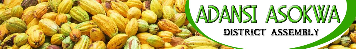
Double maxima rainfall regime is experienced in the district. The annual total rainfall is between 1,250 mm and 1,750 mm. (50” – 70”). The major rains occur between April and July whilst the minor rains occur between September and December. Relative humidity is high about 80% in the rainy season and 20% in the dry season. The temperature and rainfall pattern enhance the cultivation of many food and cash crops such as cocoa, oil palm, citrus, vegetables, yams, cassava, cocoyam, cereals etc.
As a result of the double maxima rainfall pattern, there are two cropping seasons, these are; the major cropping season and the minor cropping season in one year. The climate also supports forest vegetation which supports the growth of wood lots like odum, wawa, sapele etc. These are harvested for export to earn foreign exchange. Some are also used locally to create jobs for the citizens.
Vegetation
Owing to the climatic conditions experienced in the district, the vegetation is naturally a semi-deciduous forest. This kind of vegetation is characteristically made up of three layers; namely the under growth, the middle layer and the upper layer.
It supports the growth of big and tall trees of different kinds which are not in pure stands. Some are hard wood others are soft. Examples are wawa, sapele, odum, mahogany etc.
Conditions of the Natural Environment
The Natural environment of the District originally was hilly, in terms of relief, and this was accompanied with rain forest vegetation.
The hills can still be seen throughout the district. In between the hills are valleys most of which contain streams. Unfortunately, about 80% of the rainforest vegetation in the district has been destroyed due to improper farming methods like slash and burn, bush fallowing, shifting cultivation, continuous cropping, plantation agriculture, etc.
The vegetation of the district has changed from its original rain forest vegetation to secondary forest vegetation.
Again bush fires and illegal chain saw operation have also contributed to the disappearance of the tall and giant trees which previously were in abundance in the District.
Despite the rapid change of the natural environment virgin forests, still exist in the district in the forest reserves which are a beautiful site to watch.
Conditions of the Built Environment
Most of the communities in the district face serious problems with erosion due to the hilly nature of the district.
A community like Asokwa the District capital, though an ancient town is not able to expand because, it is surrounded by hills and valleys. The people are therefore forced to build their houses close to each other without any regard to the planning scheme. The community just like many others in the district faces serious erosion. As a result, deep gullies are found in the town and the foundations of most buildings are exposed. Communities like Brofoyeduru and others face similar situation.
Relief (Topography) AND DRAINAGE
The District has an undulating terrain with more than half the total area rising to an average height of about 300 meters above sea level. In general the district is located in a hilly area. For this reason though there is land, most of it is not available for use since they are hilly. Again the hilly nature of the land makes transportation difficult, since so many culverts have to be constructed on the roads to make them passable, which unfortunately is very costly, making a lot of the roads lack the facility, hence rendering them impassable during rainy seasons.
Generally, the District has several streams depicting a typical dendritic pattern. Major streams in the district are: Fum, Gyimi, Adiembra, Konwia, Asabiri, Kyekye, Subini, Kyereboro etc. Most of these rivers are used for domestic and industrial purposes. Most of them are perennial and the area is well drained. As a result of this, farmers cultivate vegetables during dry seasons, and this has helped many farmers to be in business throughout the year.
If this is encouraged, and irrigation facilities are provided for these farmers, it will help to improve upon the income levels of the people to help reduce poverty in the district.
Major soil type
The major soil types in the district are Forest Ochrosols which develop well under moderate rainfall between 900 mm and 1650 mm. They develop under forest vegetation. They are rich in humus content. The soils are well developed with well-defined profiles. The soil supports meaningful agricultural production.Cash Crops like Cocoa, Oil Palm and Citrus are cultivated by farmers from all parts of the district.
The agricultural sector employs about 77% of the total labour force in the district. The district is divided into four Zones with regards to extension services. Some of the crops grown in the district are; Cocoa, Oil Palm, Citrus, Coffee, Maize, Cassava, Plantain, Cocoyam, Yam, Rice, Vegetables, Pineapple, etc. As is happening in other parts of the country, the agricultural sector in the district is facing so many problems. Some of these constraints include; Lack of credit, Poor feeder road network, High cost of farm labour, difficulty in the acquisition of farm land (land tenure system), unattractive prices of farm produce, high cost of farm inputs, post-harvest loss etc.
Natural and Man-made Disasters
DISASTER
Disaster can be explained as sudden great misfortunes, which happen to people; examples are wind storms, floods, Domestic/Natural fire outbreaks, droughts, earthquakes, volcanic eruption, outbreak of diseases, etc.
Though disasters occur in the district, the rate at which they occur is minimal.
RAIN / WIND STORM
This is one of the most frequently occurring disasters in the district. Community projects such as a market at Nyankomase, a church building at Nyamekrom, and a public toilet at Akwanserem were destroyed by rain storm. In February, 2010 similar incidence occurred at Nsokote, Fumso, Asokwa, Anwona, Anomabo, Hweremoase and Old Ayaase the cost of these damages ran into several thousands of Ghana cedis.
The basic cause of these disasters was attributed to the absence of trees to in the communities to serve as windbreaks.
FLOODS
There has not been any incidence of flooding in its truest sense in the district since the flood plains of most of the rivers in the district are well drained. However, deep gullies created by erosion are seen in most of the communities. The hilly nature of the district is responsible for this development. This is because most of the communities are sited in broad valleys, which separate the hills.
BUSH FIRES AND DROUGHT
Bushfire outbreak in the district is also on a low side. This could be attributed to the intensive educational campaign mounted by the National Disaster Management Organization (NADMO) and the personnel of the National Fire Service in the district.
DROUGHT
The District does not usually experience any acute drought, since the atmosphere has very high humidity and there is a double maxima rainfall regime in the district. Therefore apart from the normal dry seasons which occur between January and March every year, drought has not been a major problem of the district. However, indiscriminate logging by chain saw operators in the district has caused a substantial damage to the vegetation. What is even more worrying is when trees along streams are felled indiscriminately causing some of the streams to dry up during the dry seasons.
Geology and Minerals
The area consists of Tarkwain (pre Cambrian) and upper Birimian rocks noted for their mineral bearing potentials. These rocks are quarried for constructional works such as building and road construction.
Most parts of the District lie within the Gold belt. Despite the presence of these rich resources, meaningful mining or extraction activities are yet to be carried out in the district.
Biodiversity, Climate Change, Green Economy and Environment
Biodiversity forms the foundation of the vast array of eco-system services that critically contribute to human well-being. Plants, Animals, aquatic species, fora and fauna are protected from human activities that endanger living organisms within the District. The Assembly incorporates Strategic Environmental Impact Assessment (SEA) in its MTDP that guide project and programme implementation.
This helps subject project and programmes to careful environmental tools such as Internal Consistency matrix and sustainability matrix that limit negative impacts that such projects may have on biodiversity and environment in general. Site Sensitivity Assessment is conducted and screening reports submitted to Environmental Protection Agency (EPA) for permits before projects and programmes are implemented. The site sensitivity assessment takes into consideration physical, biological and cultural resources that could be endangered as a result of project and programme implementation.
Climate change is now a major hindrance to successful agricultural development and it adversely affects agricultural activity since farming in the District is rain-dependent. Rain fall pattern is changing, the sun heat and intensity is increasing due to the negative effect of human activities on the climate. These negative effects are the indiscriminate felling of trees and other forms of pollution, which have seriously affected the rainfall pattern. The Department of Agriculture has been recording low food production, low nutrition and can result to high level of food insecurity. There is the need to protect the remaining trees and also embark on tree planting exercise within the plan period as well as educating farmers on the dangers of farming along river banks and improper use of chemicals.
Water Security
The ability to access sufficient quantities of clean water to maintain adequate standards of food, goods production and sustainable health care is in line with the Assembly’s quest for access to safe drinking water for its citizens. Currently, about 76% of the population have access to potable drinking water such as mechanized boreholes, boreholes fitted with pumps and hand dug well fitted with pump. However, the menace of illegal mining if not completely eradicated will have negative impact on water security due to the pollution of water bodies by illegal miners.
Natural Resource Utilization
The District is endowed with vast natural resources which when utilized will increase wealth and well-being of people. The resources include minerals, agriculture and water. The mineral resource includes gold deposits, granite and diamond.
The mineral resource is under-utilized as only few people are engaged in artisanal mining. If Mining Companies could invest with a modern method of mining using technological and technical advancement that does not degrade the environment, then, the people could benefit on a large scale from the resource. The District has vast land for agriculture which employs majority of the people. Agriculture still is done on subsistence level with simple farm tools such as hoes and cutlass by these people.
If Agriculture could be seen as a business and mechanized agriculture techniques employed, then, the agriculture resources could fully be utilized. These would change the face of agriculture in the District form subsistence farming with simple tools like hoes and cutlass to commercial/ plantation agriculture with combine harvestors, harrows, ridgers and mounds, then, food sufficiency both locally and nationally could be achieved. Forest products such as oil palm and timber can also be found in the District.
Trees such as Wawa, Odum, Mahogany and Onyina that can be felled for timber are in abundance in the District. As a result of non-formalization of the timber trade, illegal chain saw operators take advantage to fell trees illegally. If activities of these Chain Saw Operators could be regularized, then, the forested product can be utilized fully to boost the local carpentry and wood carving business.
ENVIRONMENTAL CONDITION
Soil erosion in the district is on the increase in the farming areas as well as in the built environment.
Implications of the Physical Features of the District for Development
Location and Size: Adansi Asokwa is located in a tropical rainforest region where rainfall and temperatures are uniformly high throughout the year. The location of the district in a forest area therefore gives it a comparative advantage in the production of crops like oil palm, citrus, cocoa, plantain, cocoyam, cassava etc. In terms of size, the district is relatively big; this therefore makes the distribution of resources relatively difficult, and costly.
• Relief: The District is located in a hilly area; this makes road construction very difficult and expensive, however, the hilly nature promotes greenery environment due to frequent rainfalls and difficulty in farming on mountain tops.
• Climate: The District experiences a double maxima type of rainfall. This has made it possible for farmers to enjoy two cropping seasons, the major and minor cropping seasons in one year. This is good to keep farmers in business throughout the year.
• Geology and Minerals: Most parts of the District lie within gold and sand belts. Unfortunately, no meaningful mining or extraction activities have taken place in the district.
• Soil type and Agricultural Land use: The major soil type in the district is forest ochrosols which is rich in humus content. This is a very good ingredient for Agricultural development, considering the fact that Agriculture employs about 77% of the total work force in the district.
Date Created : 2/11/2019 3:03:41 AM


- District Sublinks
- Other Links
- Other Officers
- Downloads
- Saboba: Compensation 2022

 facebook
 twitter
 Youtube
 TOLL FREE 0800 430 430
 +233 593 831 280
 GPS: GE-231-4383
 info@ghanadistricts.com
 Box GP1044, Accra, Ghana