Relevant Data
Location and Size
The Sekyere Kumawu District is located between Latitudes 0° 20 and 1° 20 North and Longitudes 0° 45 and 1° 15 West. It covers an estimated land area of 1,500.6 square kilometres, which is 6.2 percent of the total land of Ashanti Region. The District shares boundaries Sekyere Central District to the west, Sekyere East and Asante Akim North Districts to the south and the Sekyere Afram Plains District to the east. Kumawu, the capital is about 54 kilometres north-east of Kumasi, the capital of Ashanti Region.
Climate and Vegetation
The district experiences the wet Semi-Equatorial climate. The district has monthly mean temperature of 24oC even though some part of the district records lower figures. Rainfall comes in two seasons in a year. The major rainy season is from March to July whilst the minor rainy season is from mid-September to November with peaks occurring in July and November, respectively. The District has relatively high humidity due to the forest cover.
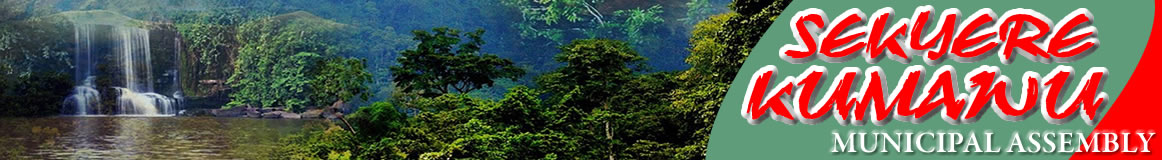
The vegetation is semi-deciduous forest which occurs mainly in the Middle Belt of Ghana. The agro-climatic condition supports the growth of big and tall trees of different kinds, such as, Wawa, Sapele, Odum, and Mahogany. Parts of the district are fast degenerating into secondary forest due to large scale clearing of water sheds, particularly, around Kumawu and it is one of the major causes of acute shortage of water supply, especially, during the dry season. The northern part of the district is covered with Guinea savannah which consists of short deciduous fire resistant trees. The savannah zone covers about 70 percent of the district while the forest zone accounts for the remaining 30 percent (Sekyere Kumawu District Assembly, 2008).
Relief and Drainage
The District is divided into two by the Kwahu Scarp running westwards. The southern portion of the scarp has undulating characteristics, with the highest point of about 400 meters at Woraso near Kumawu. In the south-western portion is the heavily dissected slope of the Wenchi-Koforidua Scarp with hills rising to 330 metres. Overlooking the Ongwam and Boumfum Valleys is a gentle slope that extends to the north-east, rising to about 105 metres above sea level.
Date Created : 12/6/2017 2:19:26 AM
Leadership


Vital Links
- District Sublinks
- Other Links
- Other Officers
- Downloads
- Saboba: Compensation 2022
Handy Data

 facebook
 twitter
 Youtube
 TOLL FREE 0800 430 430
 +233 593 831 280
 GPS: GE-231-4383
 info@ghanadistricts.com
 Box GP1044, Accra, Ghana