Climate
The climatic conditions in the District conform to that of the Middle Belt of Ghana. The District has a monthly mean temperature of 26oC and a maximum temperature of about 29oC. The total annual rainfall is estimated to be 1,331.7 mm. There are two rainfall seasons per year; the major rainy season is between April and June whilst the minor season ranges from September to November.
The main dry season occurs between December and March and is associated with drought conditions. This period is characterized by relatively high and low temperatures during the day and night respectively. Streams and ponds dry up during this period and crop farming usually comes to a halt except vegetable growing undertaken along the banks of rivers and streams.
Vegetation
The District lies within the Forest and Savanna Transitional Agro-ecological Zone of the country. It has a mixture of forest and guinea savannah and consists of short deciduous fire resistant trees like Lophira laccolite. The transitional zone covers about 70 percent while the forest vegetation covers the remaining 30.0 percent of the total area. The District is fast degenerating into secondary forest due to unfavorable human activities like charcoal burning. It is now a wooded savannah which shelters the north-eastern part of the Ashanti Region. The vegetation suffers from annual bush fires and the ecosystem appears to be under threat from human use of fire.
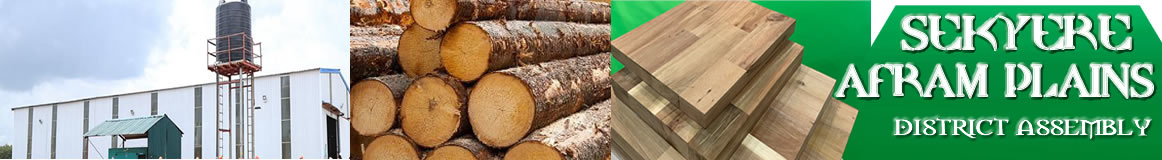
The most common timber species available in the District are Mahogany (Khaya ivorensis), Wawa (Triplochiton scleroxylon), Kyenkyen (Antiaris toxicaria), Teak (Tectona grandis), Odum (Milicia excels), Okoro (Albizia zygia) among others.
Relief and Drainage
The District boasts of the following rivers: Drobon, Afram, Afram-Obosom, Ongwam and Boumfum. Drobonso, the District capital actually derives its name from the River Drobon, which lies in the heart of the town. Few meters away from the capital lies the Afram River.
In terms of relief, it lies in the Afram-Obosom divide with a scarp overlooking the Afram River which is 180 metres above sea level. Behind the Afram-Obosom divide is a large undulating area, which slopes to the Sene - Volta and Obosom Rivers; the height is between 90 metres and 150 metres above sea level.
The northern part of the District lies on the basin of the Volta River and it is drained by the Afram, Ongwam and Boumfum Rivers. During the rainy season, most of the streams and rivers overflow their banks and disappear entirely in the dry season. Even in the case of River Afram, it sometimes becomes a chain of pools during severe dry season and this adversely affects the livelihoods of the population as they spend much time and walk long distances searching for water. Also, as a result of the drying of streams and rivers, fishing has become a seasonal activity in the District. Aqua culture could be explored to make fish farming a year round activity. An alternative livelihood for fishermen therefore is necessary to safeguard their means of livelihood.
Geology
The soils found in the District can be grouped according to the geological formations from which they developed. The four main geological formations in the District are; Granitic, Birrimian, Voltarian and Alluvium rocks. Soils at the eastern part of the District are suitable for the cultivation of both cash and food crops. Cereals perform well in the transitional section of the District. The plains are also conducive for the rearing of livestock.
Date Created : 11/23/2017 6:51:47 AM


- District Sublinks
- Other Links
- Other Officers
- Downloads
- Saboba: Compensation 2022

 facebook
 twitter
 Youtube
 TOLL FREE 0800 430 430
 +233 593 831 280
 GPS: GE-231-4383
 info@ghanadistricts.com
 Box GP1044, Accra, Ghana